Geospatial case studies
Spatiotemporal Crime Hot Spot Analysis After a Major Disaster
City of Philadelphia
Project Overview
Following a simulated major natural disaster, I was tasked with analyzing robbery incidents across the City of Philadelphia to determine how crime patterns evolved over time. The objective was to identify statistically significant hot spots and detect areas where crime intensified or diminished, enabling spatially targeted crime prevention strategies.
This analysis integrates both spatial and temporal dimensions using advanced GIS statistical tools.
Problem Statement
Crime incidents are not randomly distributed in space or time. Following disasters, opportunistic criminal activity may increase in vulnerable neighborhoods. Decision-makers require precise spatial intelligence to allocate law enforcement resources effectively.
This project answers:
- Where are robbery incidents clustering?
- Which areas are intensifying over time?
- Which hot spots are persistent versus emerging?
- Where should targeted intervention occur?
Emerging Hot Spot Classification Output
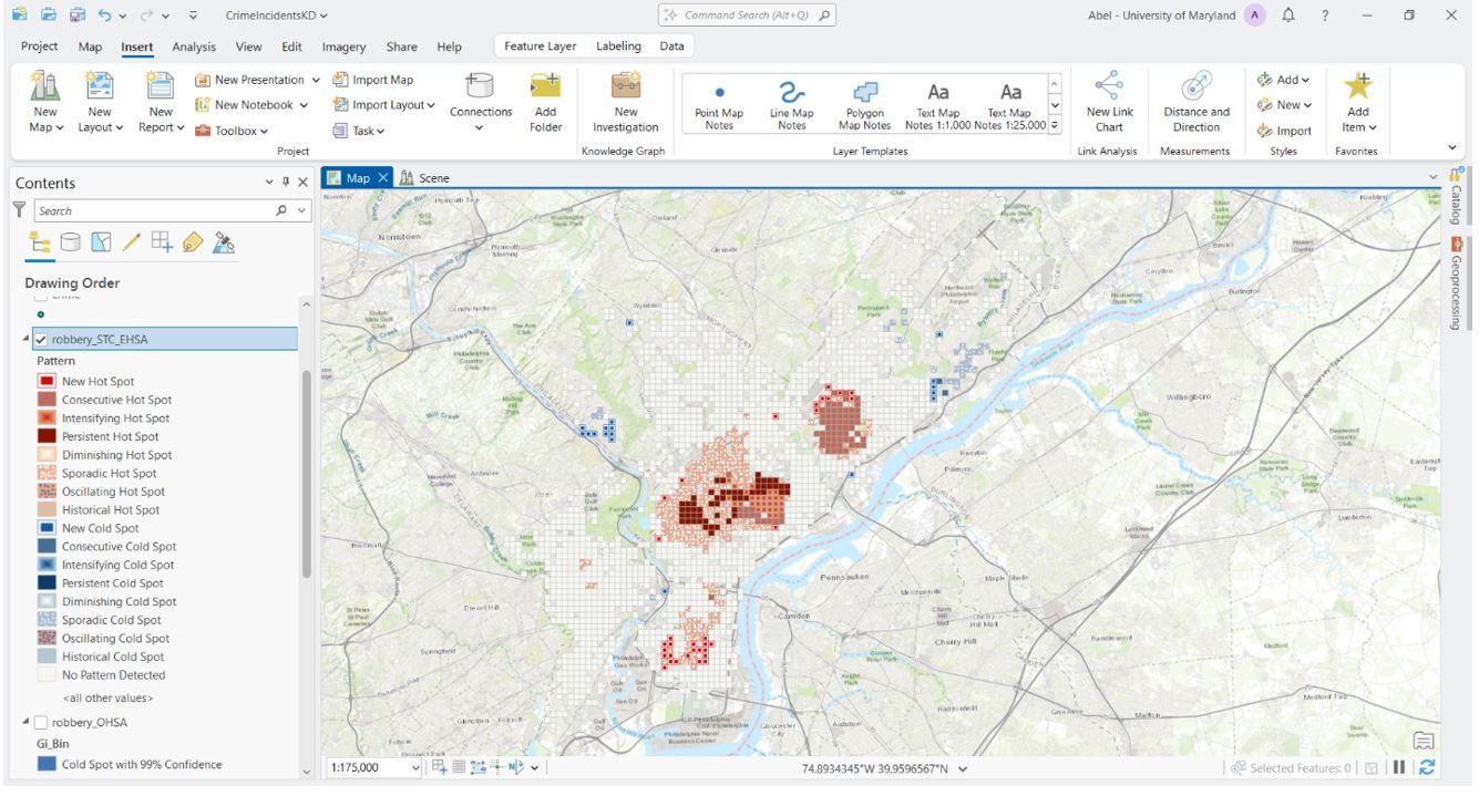
Emerging Hot Spot Analysis output showing statistically significant spatiotemporal robbery clusters categorized by pattern type.
Results
The analysis revealed:
- Concentrated intensifying robbery hot spots in specific urban corridors
- Persistent hot spots indicating long-term crime concentration
- Emerging clusters suggesting post-disaster vulnerability
- Cold spots where robbery declined significantly
- These findings provide actionable intelligence for law enforcement resource allocation and targeted intervention planning.
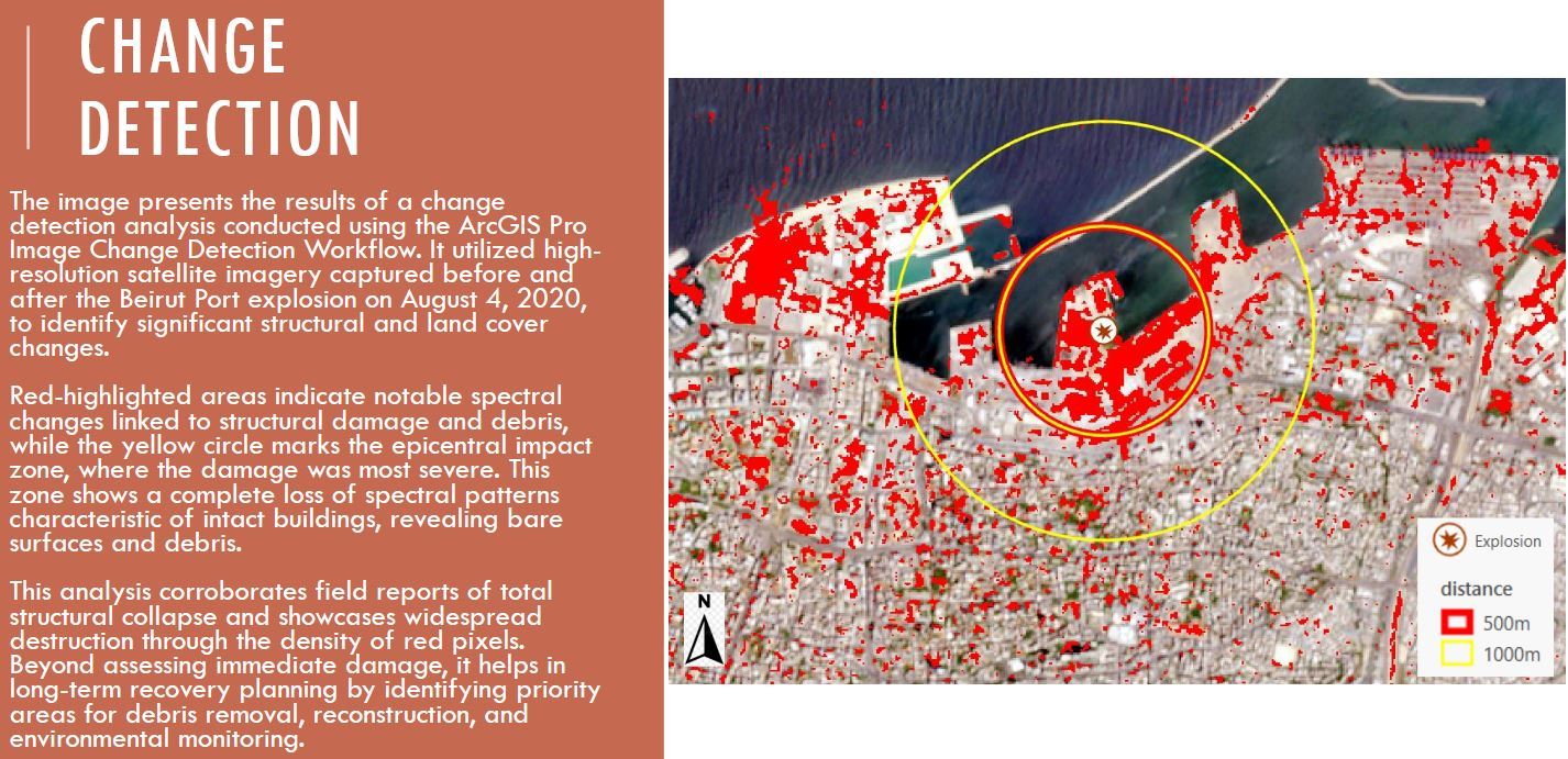
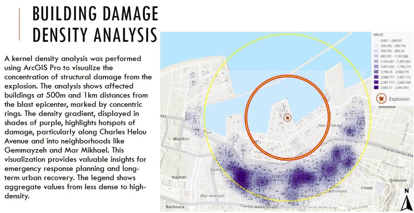
Mapping Destruction and Recovery: Beirut Port Explosion
BOTTOM LINE UP FRONT (BLUF)
In the aftermath, national and international attention turned to the root causes of poor governance and the lack of enforcement around hazardous material management. The analysis demonstrates Lebanon's lack of preparedness across all aspects of disaster management.
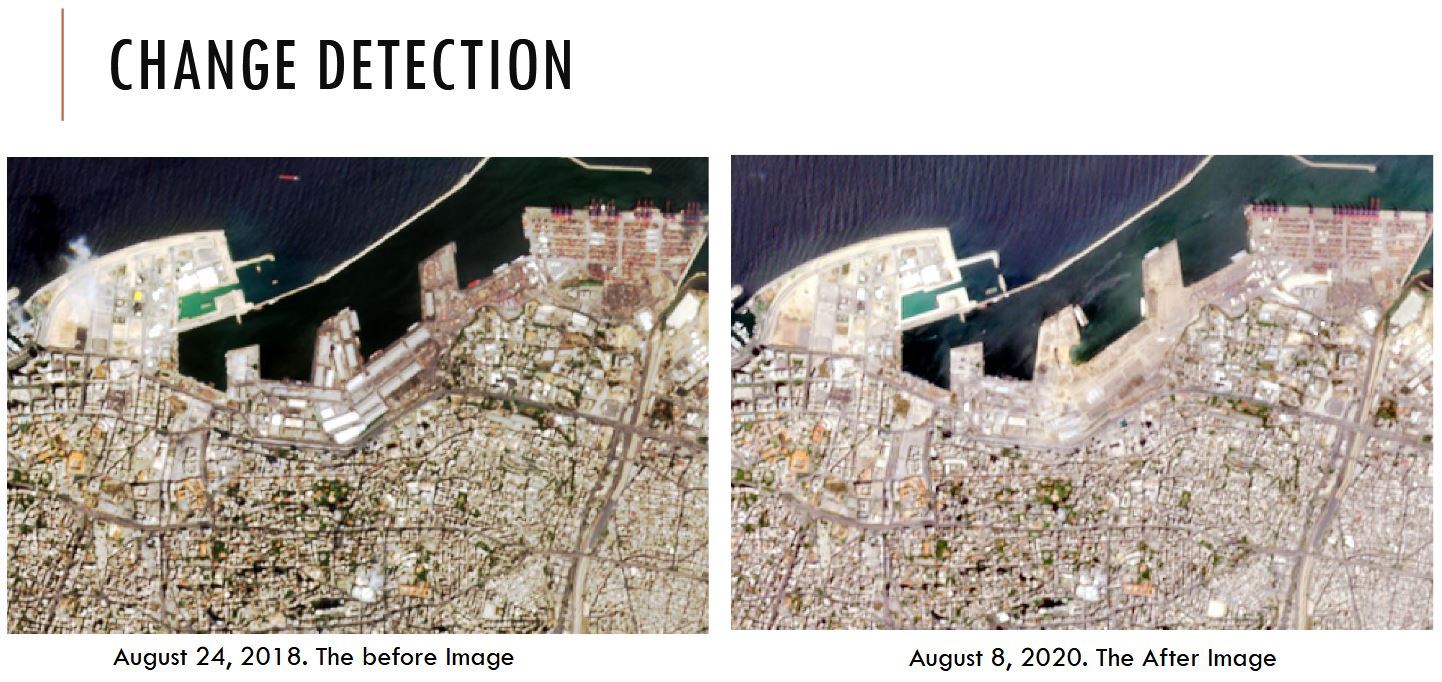
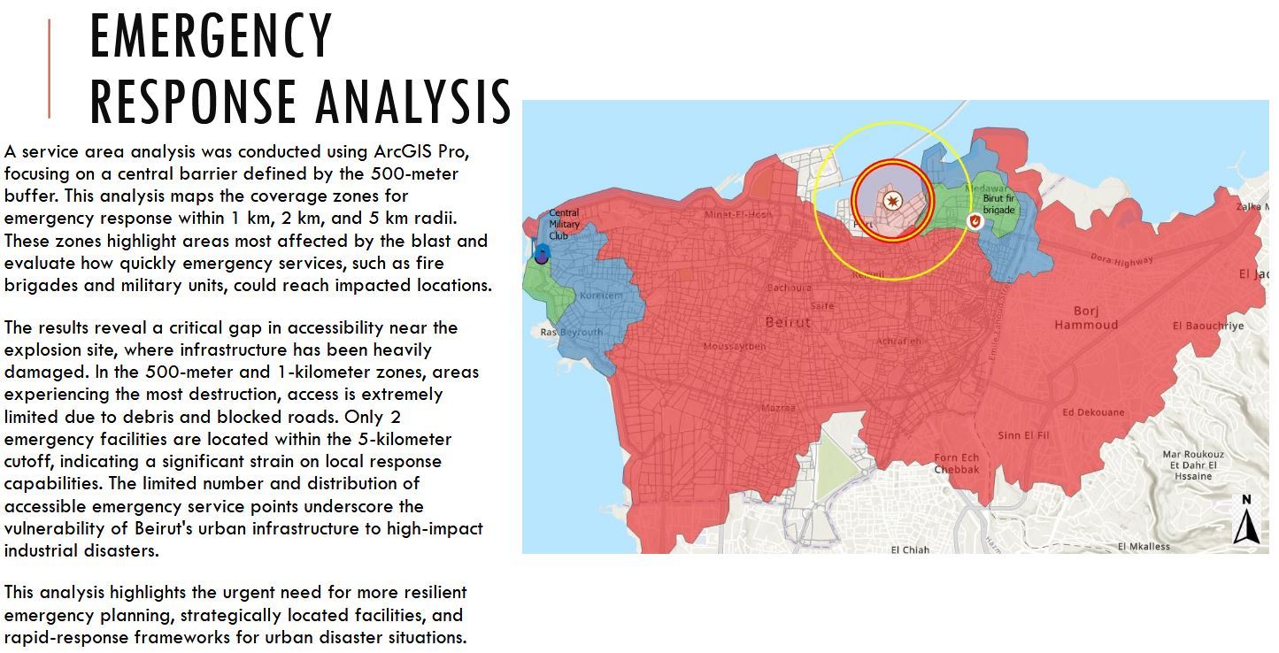
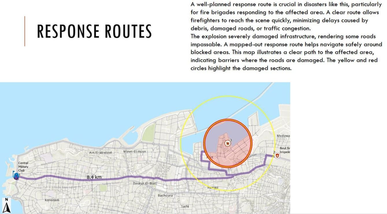
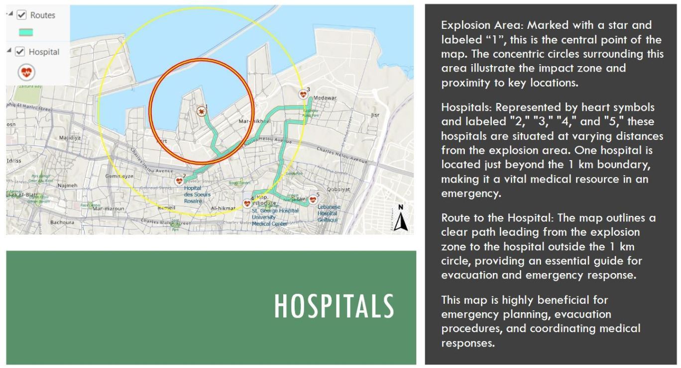
On August 4, 2020, at approximately 6:08 PM local time, a massive explosion rocked the Port of Beirut, Lebanon's primary seaport and a densely populated area near the city center. The initial fire broke out in Warehouse 12 at the Port of Beirut, causing smoke and small explosions. Shortly after, a massive explosion occurred, producing a blast wave that shattered windows, destroyed buildings, and caused destruction across a radius of several kilometers.
The source of the explosion was approximately 2,750 metric tons of improperly stored ammonium nitrate in a port warehouse since 2014. The blast killed over 220 people, injuring more than 7000 and displacing approximately 300,000 residents. The powerful shockwave generated by the explosion significantly impacted urban infrastructure, transportation networks, and environmental
conditions throughout the city.
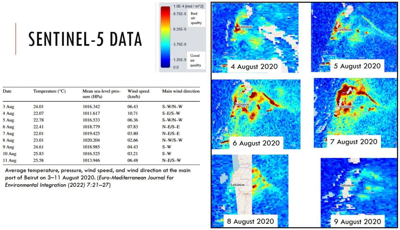
AIRBORNE TOXIC POLLUTANTS
The explosion released significant air pollutants, notably nitrogen dioxide (NO₂), a key indicator of air quality. While NO₂ occurs naturally, elevated levels from anthropogenic sources can pose serious health risks with prolonged exposure. Using Sentinel-5P satellite data, this study mapped atmospheric NO₂ concentrations before and after the blast. Findings revealed a sharp spike immediately following the explosion, with levels returning to normal within six days. The following analysis highlights the short-term impact of the disaster on Beirut and its surroundings' air quality.
Follow us

(you must be logged in to Facebook to see comments).